Scottsville GIS
Welcome to the City of ScottsvilleGIS Public Landing Point
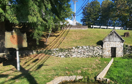
Allen County was formed in April 1815. Scottsville was named for Gen. Charles Scott, 4th governor of Ky. In 1816, this location was chosen as the county seat because of the abundant water supply from this spring. Today, ScottsvilleGIS is responsible for mapping the Scottsville water supply!
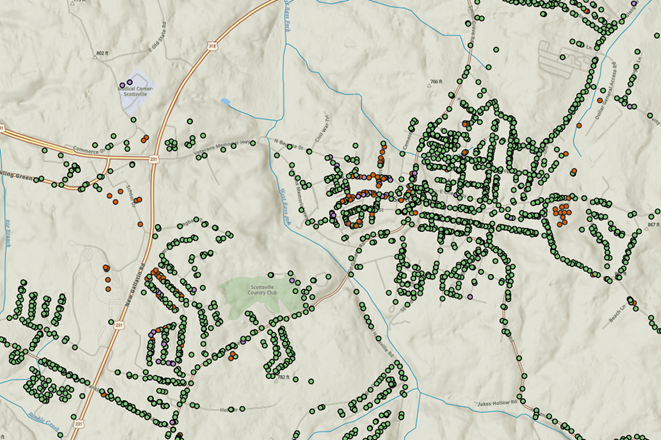
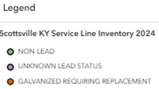
The City of Scottsville has completed a project to identify all the service lines serving customers in our system. Some customers will receive postcards that tell them that their service lines are made of galvanized steel with the potential of being downstream from lead. For more information you can reach out to Scott Dobler sdobler@cityofscottsville.org or call at 802 321 8474. Here are a few hyperlinks: Scottsville Survey Map (The Map Above), CheckYourPipes and US EPA
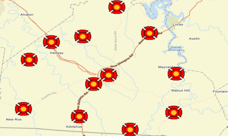
Here is a Map of all the Fire Departments in Allen County. Follow this Link for Details